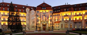
ESPRIT TRAVEL, s. r. o.
Vajanského 5270/1A
Piešťany, Slovakia
Europe
About Slovakia
Area: 49,034 square kilometers
Population: 5,417,000 people
The capital city: Bratislava with 446 000 inhabitants
Slovakia lies in the heart of Europe. With an area of about 49,034 square kilometers and almost 5.5 million inhabitants it is only slightly bigger than Denmark, Switzerland or the Netherlands. Its territory from east to west can be crossed by plane in only half an hour. In Slovakia, the longest border line lies between Poland in the North and Hungary in the South. It shares borders with the Czech Republic and Austria in the West and Ukraine in the East which is the shortest border line (only 96 km). Slovakia is predominantly a mountainous country with no access to the sea. The nearest sea to Slovakia is the Adriatic Sea (361 km)in the south. The land of Slovakia although is small in size but rich with various tourist attractions and can offer to its tourists many opportunities for recreation, sport and recreation.
Density of the population: 109.9 persons/km²
Official language: Slovak
Capital: Bratislava (446,819 people)
State Formation: 1st January 1993
Membership in the EU: 1st May 2004
Membership in international organizations: UN, OECD, WTO, the Visegrad Four, NATO, EU
President: Andrej Kiska
Administrative division: 8 self-governing regions (Bratislava, Trnava, Trenčianské Bystrica, Zhilinskaya, Banská Bystrica, Prešov, Košice)
Geography:
The Slovak Republic is located in Central Europe. Country profile is characterized by a relatively high elevation. Much of central and northern Slovakia is covered by mountains, passes through the territory of the Carpathian arc. The lowlands are being dominant in southern and eastern Slovakia which are important agricultural areas of the country. The most affluent and important river is the Danube, which connects Bratislava with two large cities of Europe - Vienna and Budapest.
Geographical position:
Patince (47º43'55 "longitude), Oravská Polhora (49º36'54" longitude) Zagorska Weight (16º50'04 "latitude), Nova Sedlica (22º34'20" latitude)
Max length:
428 km (Zagorska Weight [West] - Nova Sedlica [east])
Maximum width:
195 km (Sturovo [south] - Rocky [north])
Altitude (min./Max.):
95 m (Bodrog) - 2656 m (peak Gerlach)
Nationalities:
Slovaks (85.6%), Hungarians (10.8%), Roma (1.8%), Czechs (1.2%), Ruthenians (0.3%), Ukrainians (0.3% ), Germans (0.1%), Poles (0.1%), others (0.2%)
Religion:
Catholics (60.3%), Lutherans (6.2%), Greek Catholics (3.4%), Orthodox (0.6%), atheists (9.7%), unknown (18.2%)
Climate:
The Slovak Republic is located in the moderate zone with distinct alternations of the four seasons. The average daytime temperature in winter is 2 ° C and accordingly 21 °C in summer. The coldest month - January, the warmest - July and August. Snow cover at the highest altitudes is present for the average of 130 days a year.
Main industries:
coal mining, chemical industry, iron ore processing, fertilizers, plastics, car manufacturing, electrical engineering.
The new democratic environment in the early 90's of the last century brought the disintegration of the joint state of Czechs and Slovaks ( Czechoslovakia), and the emergence of an independent Slovak Republic.
From the 1st of January 1993 Slovakia became an independent and sovereign state and was admitted to the UN. The residents elected the first president of the country and gradually implemented a number of free and democratic elections. Slovakia joined and was accepted as a member of European institutions and organizations. Since 2004, the Slovak Republic is a member of the North Atlantic Treaty Organization (NATO) and equal member of the European Union. In the late December 2007 the Slovak Republic was accepted into the community of states of the Schengen area. In 2009, Slovakia became the 16th member of the European Monetary Union - the Eurozone and introduced euro as its currency.
Source: Slovak Agency for Tourism


